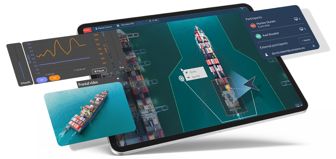
We are reinventing how drones are operated by integrating smart technology into the data acquisition process to provide our users with the tools they need to simplify and enhance their operations.
Pierre Pelé – CTO
Embedded operating system
Uavia develops and maintains a proprietary embedded operating system: DroneOS.
It is compatible with a wide range of autopilots (DJI, Parrot, Ardupilot, and PX4) and payloads. A drone equipped with DroneOS is referred to as a “Uavia Inside drone.”
DroneOS provides Uavia’s autonomous navigation for all machines, maximizes the benefits of 4G/5G cellular networks, runs third-party algorithmic models, and ensures centralized version control and maintenance management from the web platform.
Web Application
The platform enables fleet management of drones per site as well as remote flight supervision (BVLOS) from a simple web application.
Whether missions are planned or spontaneous, the web application allows real-time data visualization and sharing, secure data storage, and retrospective data analysis through various tools (filters, search engine, tags).
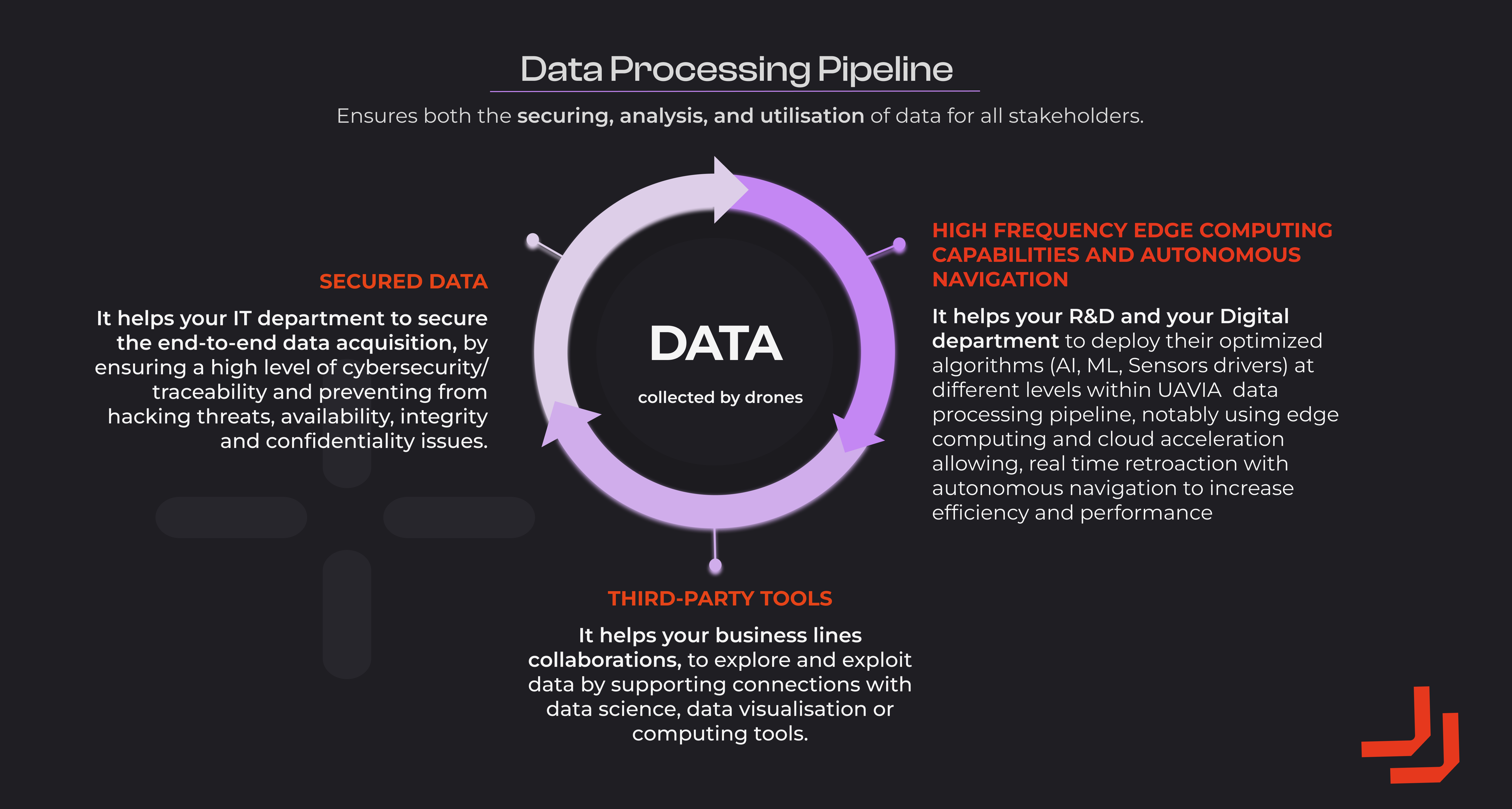
Data at the heart of the strategy
Videos, thermal images, audio, gas data, etc. Regardless of the captured data type, they will pass through the Data Processing Pipeline of the Uavia platform. This provides Uavia users with the highest security at all levels and the greatest flexibility in data exploitation.
The platform’s native functionalities
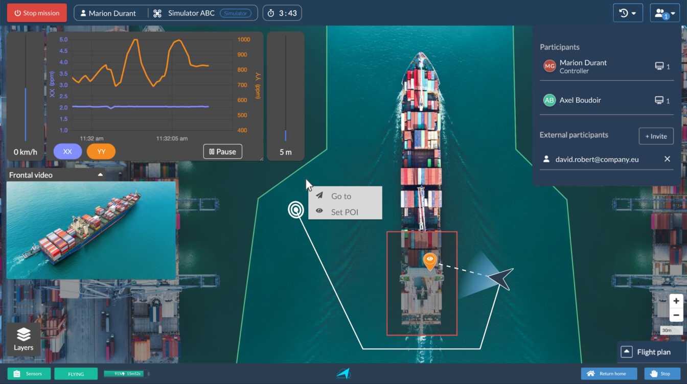
Click&Go navigation
Click directly on the map background or on the video stream where you want the drone to go, while also defining a point of interest toward which the payload will orient itself during navigation.
The embedded operating system will make the right decisions to automatically navigate around obstacles configured during your site setup.
Automatic flight plans
Create your flight plans to launch missions with a single click and supervise the drone as it carries out its tasks based on the instructions provided by you.
You can create as many flight plans as you want, and you will find them during flight through an easily accessible library.
Flight plans can be paused, allowing you to regain control in Click & Go mode, resume the flight plan at any time, or change it.
Automatic trigger mission
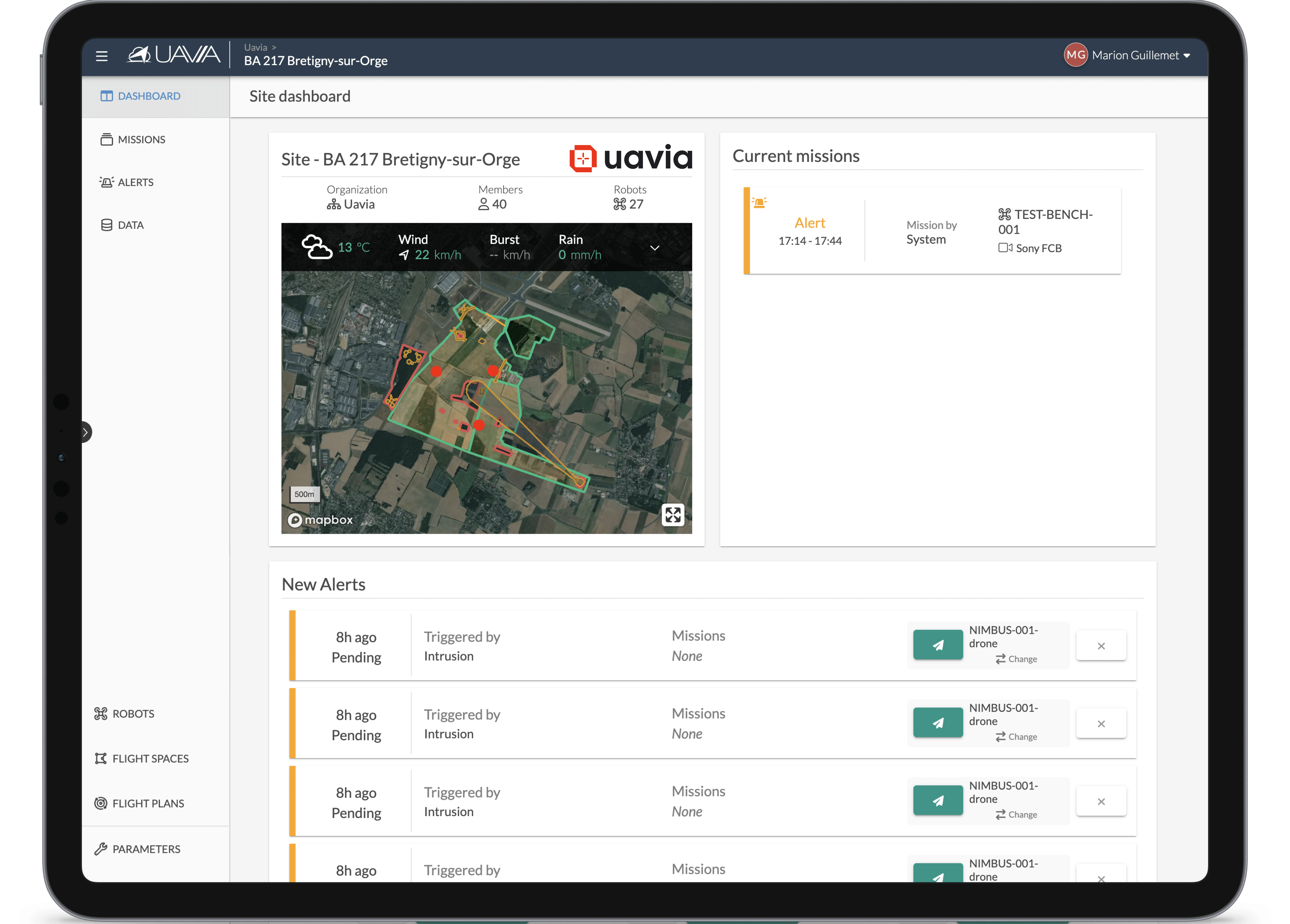
By connecting your own alarm systems (intrusion detection system, lone worker protection, fire detection system, etc.) to the Uavia platform, receive instantly qualified alerts on your dashboard.
With a single click, you can trigger a verification process that will instantly select the drone best suited to carry out the mission and autonomously navigate it to the alert point.
This feature is even more effective in the context of deploying drones with docking stations.
→ These three types of navigation are interchangeable in-flight, effortlessly.
Payload control
During a flight, access intelligent functions to make the most of the payload and optimize your mission.
These functions will depend on the deployed payload.
Live visualization
Visualize in real-time the data collected by the payloads carried by the drones: videos, infrared videos, concentrations of certain pollutants, greenhouse gases, or air components.
Perform scans of specific areas either manually if you know the area to quantify or automatically (autoscan) by letting the intelligent Uavia Inside drone navigate in the most optimal way to collect the data you need.
Invitation of remote participants
Invite internal collaborators or external participants to view ongoing missions.
Remote participants can then observe the flight and the measured data in real-time, according to your specific needs.
During an emergency situation, no longer waste precious time juggling between different tools: ensure everyone is on the same page at the same time by making Uavia your collaborative platform for critical decision-making assistance.
Exploitation of collected data
All your data is available as soon as your mission ends, within a unified and secure environment. They are enriched with a large number of metadata, including date, position, drone name, sensor name, operator name, wind parameters, etc.
You can classify them by creating the themes of your choice to find them more easily through various search tools: the search engine, filters on metadata, and the tag manager.
In the specific context of gas/particle quantification, the system allows you to identify potential concentration peaks and locate their origin on the map background to facilitate your analysis.
All data is viewable and shareable based on the permissions you have determined for each collaborator, according to your internal policies.
The raw data is sometimes extracted via the Uavia platform’s APIs by our clients, who process it according to their own analysis algorithms.
Examples of API intégration
Intrusion alert
Several refineries and petrochemical sites in Europe have connected their perimeter detection systems to the Uavia platform’s APIs to report intrusion suspicions in real-time. As examples, the Honeywell MAXPRO Nouvelle fenêtre and Genetec Nouvelle fenêtre VMS, as well as fiber optic systems like Febus Optics Nouvelle fenêtre, are currently connected to Uavia on these industrial sites.
These interfaces enable autonomous drone verification in just a few minutes and allow tracking of an intruder, if necessary, until security agents or law enforcement intervene.
U-Space
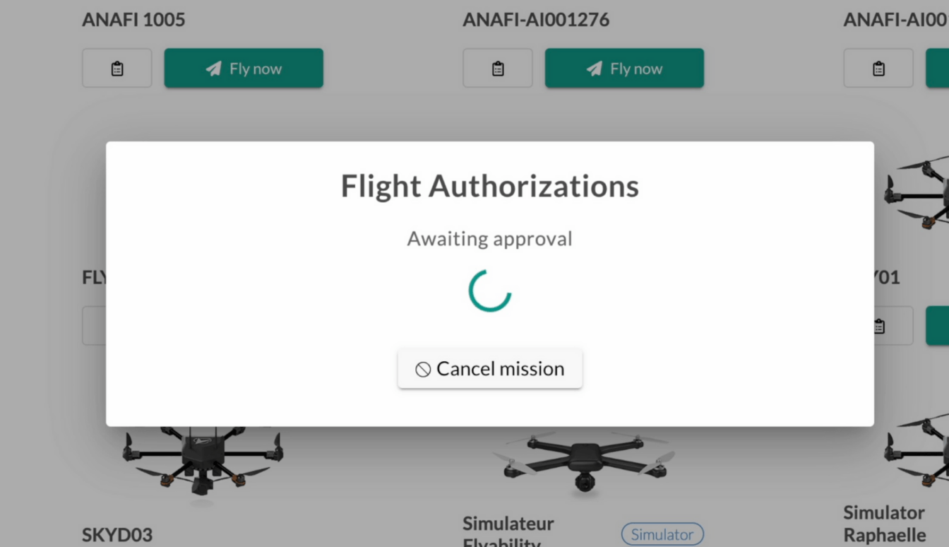
The Uavia platform has a service that enables communication with USSPs (U-Space Service Providers) to obtain real-time flight authorizations in compliance with European regulations.
A major industrial site located within the Port of Antwerp (Belgium) and a user of the Uavia platform to support its daily operations has interconnected it with one of the local USSPs: Skeydrone Nouvelle fenêtre.
This integration brings greater responsiveness to operations that require it and provides peace of mind to users regarding issues related to airspace conflicts.

